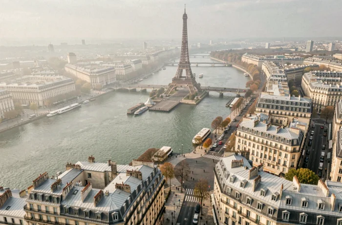
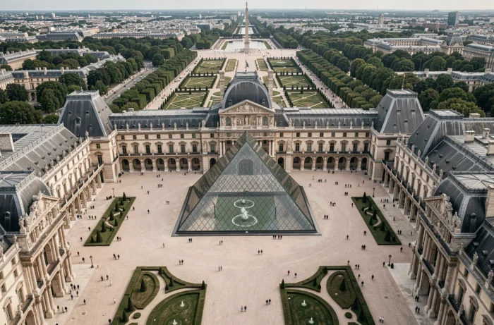
Aerial photography of Paris is based on a simple principle: moving the viewpoint from the ground to the sky to reveal geometries, alignments, and contrasts that are invisible from the street. Zinc roofs, Haussmannian perspectives, and the meanders of the Seine take on a radically different dimension when viewed from an altitude of several dozen meters.
Drone Regulations in Paris: A Nearly Permanent Red Zone
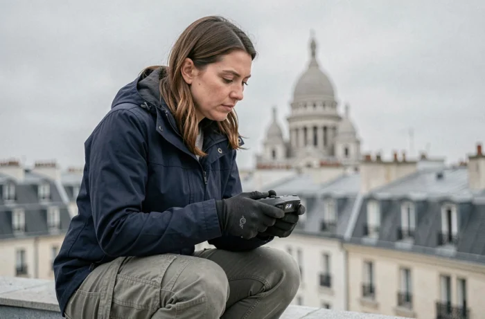
Before discussing framing or equipment, the first reality to understand is regulatory. The inner city of Paris is classified as a red zone by a permanent prefectural decree. Almost all of the airspace over the capital is prohibited for drone flights, including for recreational photography.
Only strictly regulated exemptions allow for flying: professional shoots authorized by the prefecture or civil security missions. For an amateur photographer, taking drone shots in Paris requires leaving the périphérique and checking local restrictions zone by zone.
Since January 1, 2024, European regulations have replaced the distinction between recreational and professional drones. All operations are now classified into three risk categories: open, specific, or certified. The open category, the most accessible, prohibits flying in urban areas in public space and limits altitude to 120 meters, which excludes most aerial shots in the Parisian urban fabric.
For remote pilots wishing to capture aerial images of the capital legally, it is possible to access the site parisvudavion.com to discover regulated flight options.
Specific Category and Authorizations: The Path for Professional Remote Pilots
Aerial video and photo productions conducted over Paris almost systematically fall under the specific category. This classification requires a formal risk analysis, often based on the SORA (Specific Operations Risk Assessment) methodology, and obtaining prefectural authorizations before each flight.
In practical terms, a professional remote pilot wishing to capture aerial views of Parisian monuments must compile a file including several elements:
- A declaration of activity with the DGAC and an up-to-date competency certificate for the targeted category
- A request for prefectural exemption specifying the zone, date, altitude, and purpose of the flight
- A safety protocol describing measures to protect the public on the ground and manage collision risks
- An insurance certificate covering third-party damages related to the drone operation
This process generally takes several weeks. Videographers and professional photographers producing cinematic images of Paris work within this framework, often using FPV drones or devices equipped with high-resolution sensors.
Alternatives to Drones for Aerial Photography of Paris
The regulatory constraints have pushed photographers and videographers to explore other means of capturing Paris from the sky. Light aircraft flights remain the most accessible method for obtaining aerial views without the restrictions associated with drones in densely populated urban areas.
Helicopter flights are another option, but their cost and noise pollution limit them to productions with substantial budgets. The captive balloon, like the Ballon de Paris installed in the André-Citroën park, offers a fixed but elevated viewpoint, suitable for wide panoramas.
For photographers seeking high-angle shots without leaving the ground, publicly accessible rooftops (department stores, Tour Montparnasse, Sacré-Cœur) allow for a partial simulation of the effect of an aerial image, with a plunging angle over urban landscapes. The fundamental difference remains the shooting axis: a drone or an airplane offers a zenithal view that no rooftop can replicate.
Aerial Shooting Techniques: What Changes Compared to Ground Photography
Aerial photography alters three fundamental parameters compared to ground photography: distance to the subject, speed of movement, and vibrations.
The distance to the subject imposes appropriate focal lengths and resolutions. The sensors mounted on professional drones used for producing images of Paris generally exceed the common resolutions of consumer devices. The choice of sensor directly determines the level of detail that can be captured on roofs, facades, and vegetation.
The speed of movement, even moderate, requires working with fast shutter speeds to avoid motion blur. In FPV drones, where trajectories are dynamic and axis changes frequent, this constraint becomes critical. Specialized videographers compensate by using three-axis gimbals for stabilization.
The mechanical vibrations of the drone or aircraft are transmitted to the sensor. Without effective stabilization, even a sharp image in the viewfinder presents visible micro-blur upon cropping. High-quality aerial cinematic productions rely on a complete chain: stabilized gimbal, high-performance sensor, and calibrated post-processing.
Light and Flight Times
The low-angle light of morning and evening produces the best results in urban aerial photography. The shadows cast by buildings reveal the volumes and depth of the streets, while the zenithal light at noon flattens the reliefs. Professional remote pilots plan their missions based on the solar orientation concerning the targeted monuments.
Paris has a particularity: the uniformity of zinc roofs creates a mirror effect under certain lighting angles. This phenomenon, problematic during midday, becomes a graphic asset during the golden hour when reflections take on warm hues.
Privacy and Image Rights: The Legal Limits of Aerial Views
Beyond aeronautical regulations, aerial photography in urban environments raises privacy issues. The GDPR applies as soon as an image allows for the identification of a person or distinguishes the interior of a private home.
A drone flying at low altitude can capture images of terraces, private gardens, or open windows. The dissemination of such images without consent exposes the photographer to legal action. Professionals apply a simple principle: any shot that allows for the identification of an individual or a private space must be blurred before publication.
This constraint directly influences the choice of altitude and focal length. The higher the drone flies, the less personal detail is visible, but the resolution required to obtain a usable image increases. Finding the right compromise between image quality and respect for privacy is part of the preparatory work for each aerial mission over Paris.